Above: The Newcomer Farmhouse. The trailhead is to the right of
the house in this view. There is parking to the left.
Above: The Newcomer Barn, across the Boonsboro Pike (Rte. 34)
from the farmhouse.
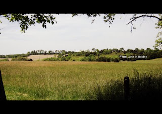
Above: Photo taken from the bend in the trail at the crest of
the steep hill on which Tidball’s Battery, consisting of six 3-in. Ordnance
RML, went into battery. The right-most section was probably in battery at this
location. Tidball’s field of fire to the west is shown. Confederate guns
crowned Cemetery Hill, the location of the National Cemetery and the Town
Cemetery, neither of which were in existence on the day of battle. The turnpike
bisected the hill. The farmroad running through a deep ravine northward toward
Bloody Lane is indicated.


No comments:
Post a Comment
Note: Only a member of this blog may post a comment.